Faringdon Community Website.
Home
Tell us about....
News,Views,Events
Posters
Regular events
What's on Calendar
Memories of Faringdon
Obituaries
Guestbook
Leisure & Tourism
Things to do
Places to visit
Tourist Information
Transport and parking
Villages and towns
Directories
Shops and Businesses
>
Faringdon Business Index
Clubs and Organisations
>
Sports
Dance drama music
Youth organisations
Various Clubs
Leisure centres
Churches
Charities, Trusts, community gps
Schools, tuition, childminders
Health services
Local Public services
Photos and Maps
History, People & Places
Faringdon Street Names
Faringdon through history
World Wars
Notable Faringdon people
Past shops and businesses
Buildings and Places
Churches and Cemeteries
Contact us
Photos and Maps
Faringdon history through photos
2023
2022
2021
2020
2019
2018 shops +
2017 shops
2017 streets
2015
2014 Shops
2013 Tesco Metro
2013
2012
2012 Folly Park View
2011
2008
2007
2004 to 2006
2000 to 2003
1996 to 1999
1994 to 1995
1993
1990 and 1991
1980s
Old Junior School 1985
Faringdon bypass 1978 and 1979
More than 70 years ago
Faringdon 1920s and 1930s
Early to mid 20th century
Sandshill
before 1939
Market Day in 19th century
Faringdon in 19th century
Before 19th century
Town and local events in pictures
Coronation. May 6th 2023
Womens cycling tour June 2022
Queen's
Platinum Jubilee June 2022
OVO Women's tour Stage 3 June 2019
The Faringdon Nativity ( with camels) 2017
Freedom of the Vale Parade June 2017
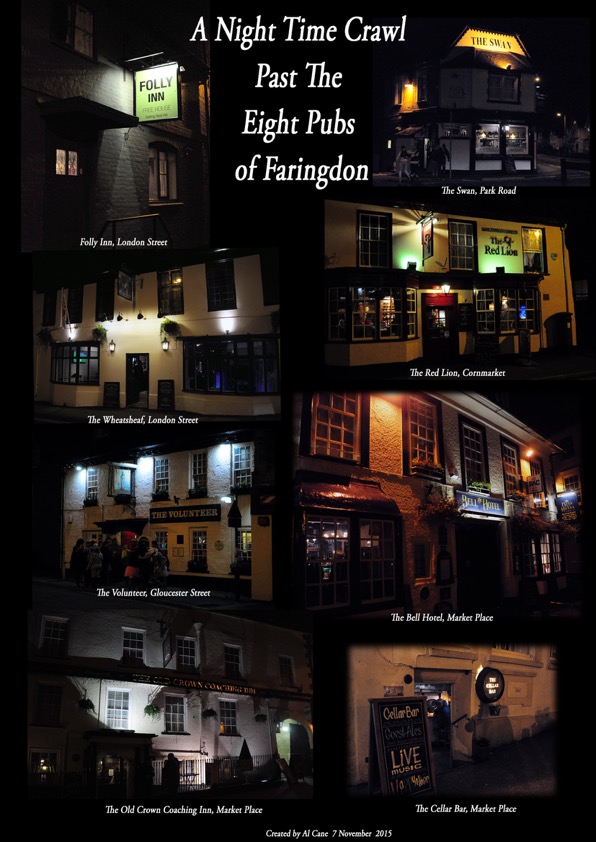
Faringdon Pubs 2015
Al Cane
Make Poverty History- White Band Day 2005
1993 when Faringdon flooded
Park Road before the bypass
1970s
The New Avengers1977, filmed at the Folly
Bailey B
ridge 1963
Faringdon Carnival 1963
Coleshill House Fire 1952
1952 Faringdon Carnival
FotoFaringdon
Faringdon Millennium Photo Project
Photos of every house and building in Faringdon
http://www.fdahs.org.uk/fotofaringdon2000/
In and around Faringdon in 1953.
Photographs by Ray Hutt
http://www.fdahs.org.uk/hutt-collection-1953/
Photo Collections
Tuckers Nursery during WW2
1906 Living Bridge
1990s Streets of Faringdon
John Stretton
Faringdon History Society 1900 Collecton
Highworth Historical Society. Faringdon Postcards
July 2019
Cycle Training Track.
Folly Sports Park
Francis Frith photos of Faringdon
Faringdon on 'Pictures of England'
Pictures of Faringdon Town Centre from the crane
Faringdon from the air 2000
Jan Jackowski's photos of Faringdon
Jan Jackowski's people photographs people
1960s
1955 Film narrated by John Betjeman. Faringdon and Great Coxwell
Maps
Faringdon and area map
Faringdon Town Centre map
(pdf)
Faringdon Conservation Area map
Town map with cut throughs
Click photo to see a bigger image
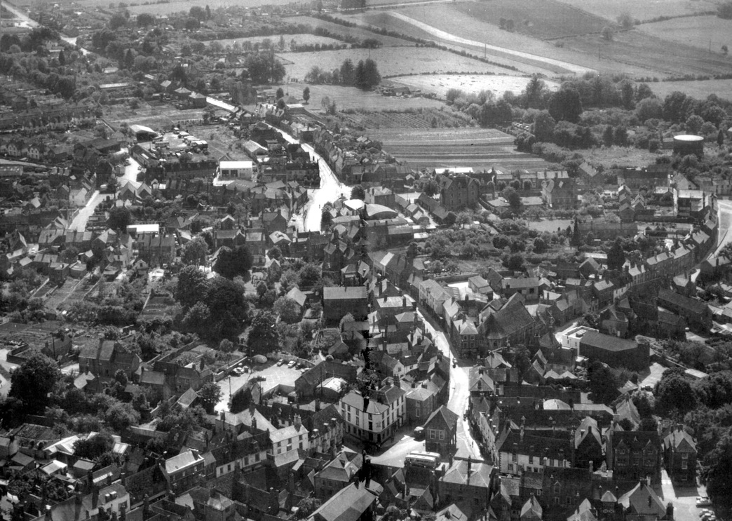
Station Road, Park Road 1962.
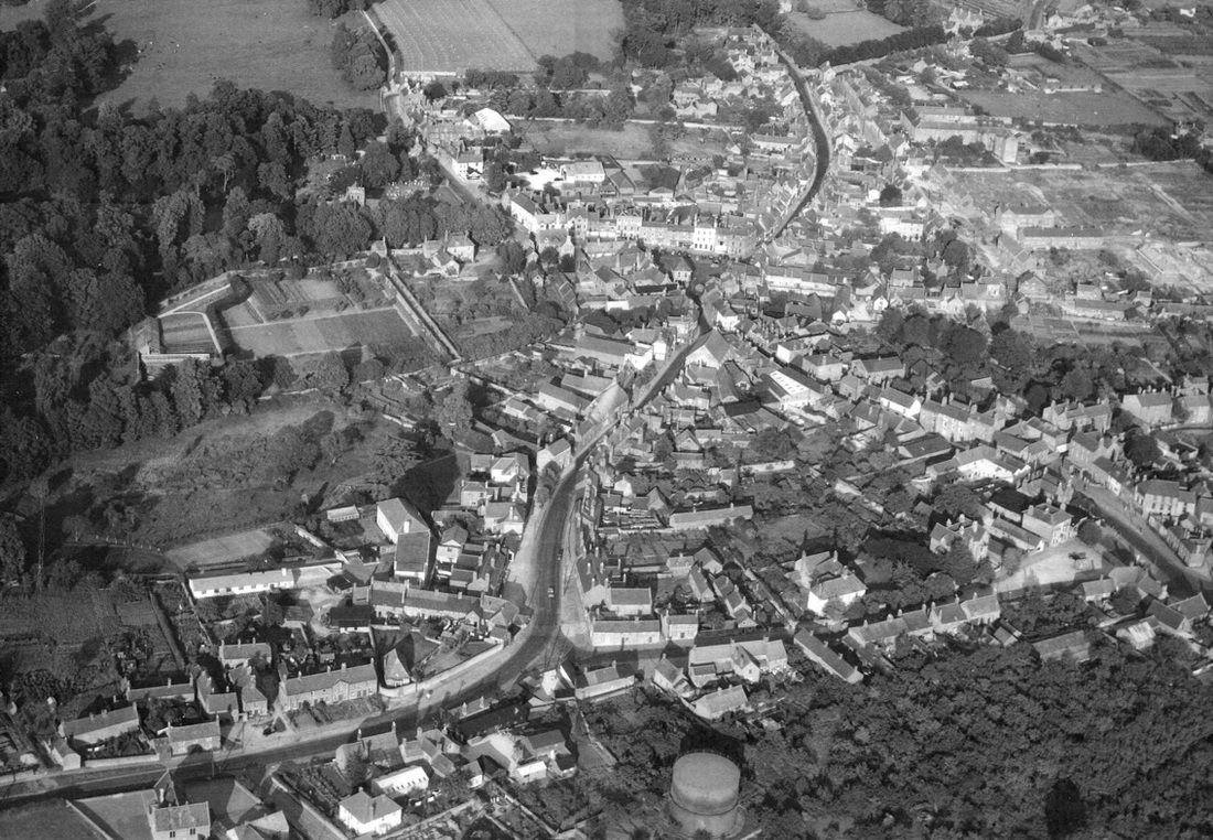
Aerial view, 1952.
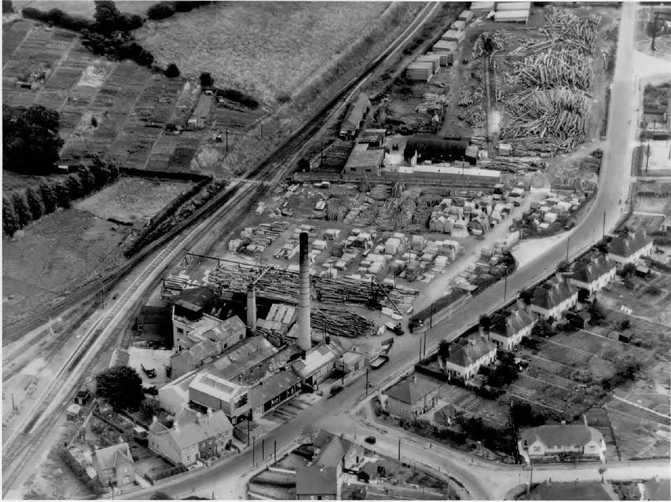
Park Road 1959. By kind permission of Jim Brown